Introduction
Sustained availability of energy at affordable cost is an essential prerequisite for the growth of a country. Currently the energy consumption per capita in case of Nepal is134 KWH per capita per year, as against world average of 2674 KWH per capita per year.
GDP Per Capita in $ (PPP)
| Country |
Energy Consumption in kWh per capita per year |
GDP Per Capita in $ (PPP) |
GDP Per Capita in $ (Nominal) |
| World Average |
2674 |
11673 |
11673 |
| Bhutan |
2779 |
3392 |
3392 |
| India |
1122 |
1980 |
1980 |
| Maldives |
1122 |
9802 |
9802 |
| Pakistan |
471 |
539 |
539 |
| Sri Lanka |
414 |
4135 |
4135 |
| Bangladesh |
351 |
1564 |
1564 |
| Myanmar |
193 |
1256 |
1256 |
| Afghanistan |
141 |
538 |
538 |
| Nepal |
134 |
900 |
900 |
Table-1: Energy Consumption Vs Gross Domestic Product
Source: 1.GDP figures for 2017 vide https://www.worldometers.info/gdp/gdp-per-capita
2.World Fact Book: Power consumption for various countries of the World.
Although correlation between energy consumption and the prosperity depends on a number of factors like population but a fact which clearly overshadows others is that as energy consumption increases the prosperity increases. This relationship is equally valid for reverse relationship, i.e. as prosperity increases the necessity for additional energy becomes obligatory. Another interesting observation can be made based on the content of this table. Bhutan is a land locked country which has hardly any major industry in that country, yet their GDP per capita is more than India’s. An examination suggests that Bhutan has adequate hydro resources and hydroelectricity generated exploiting her indigenous resources is far more than her requirement. This surplus generation is sold by Bhutan to India. Revenue thus earned has transformed the country from a poor developing country to a prosperous country quite distinct from other South Asian countries. For the record Bhutan’s revenue from hydro power is 27% of the entire govt revenue and is 14% of Bhutan’s GDP. This also flags an approach which can also help other South Asian countries to improve their economic strength by exploiting their indigenous resources. Another country of South Asia; Nepal can benefit from the model which Bhutan is currently following for sharing its energy resources with India in a ‘win-win’ situation.
Topography of Nepal

Map1: Nepal and its Rivers and Physical features
Source: https://en.wikipedia.org/wiki/Geography_of_Nepal

A report of International Hydropower Association, “Bhutan” uploaded on https://www.hydropower.org/country-profile/bhutanography_of_Nepal
- Lie of the country is such that all the rivers flow from Nepal to India.
- High Himalayas separate Nepal from Tibet, whereas southern side of the country is having a terrain which is plain and that separates Nepal from India therefore while Northern Areas of Nepal act as a barrier between Nepal and Tibet, plains in southern side of the country lends itself for cooperation between India and Nepal. Recent operationalization of an oil pipeline from Motihari in Bihar to Amlekhganj in Nepal is a manifestation of such a cooperation (Little more about it a little later.)
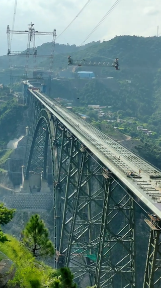
- Nepal has a huge hydropower potential. In fact, the perennial nature of Nepali rivers and the steep gradient of the country’s topography provide ideal conditions for the development of some of the world’s largest hydroelectric projects in Nepal. Current estimates are that Nepal has approximately 43,000 MW of economically feasible hydropower potential. However, the present situation is that Nepal has developed only approximately 753 MW of hydropower. Therefore, bulk of the economically feasible generation has not been realized yet. Besides, the multi-purpose secondary and tertiary benefits have not been realised from the development of its rivers. Nepal is utilising only 2% of it (i.e., 98% remains unutilised). It may be noted that an optimum exploitation of the hydro resources will contribute substantially to the financial well-being of Nepal. However, it is also a fact that Nepal neither has the financial muscle nor technical knowhow to harness its hydro resources. Therefore, support from friendly foreign countries becomes essential. China has been trying to make inroads into Nepal but whether it can be cost-effective or not is something that needs to be examined in carefully. India, on the contrary, has everything in her favour to support hydro power exploitation by Nepal. In fact power generated in Nepal can also be shared with Bangladesh using Indian grid system, which will be an excellent example of Nepal-India-Bangladesh cooperation, and still better as a BBIN (Bhutan-Bangladesh- India-Nepal) initiative and will be a ‘Win Win’ situation for all three countries. India will have to use all its traditional heft with Nepal, its diplomatic skills, financial support to beat China who is trying hard to gain a foothold in Nepal’s Hydro energy exploitation domain as they are desperately wanting power.

Map-3: River Systems of Nepal
Source: Firoz Alam et al, “A review of hydropower projects in Nepal1st International Conference on Energy and Power”, presented during ICEP2016 at RMIT University, Melbourne, Australia, 14-16 December 2016 and Available online at www.sciencedirect.com ScienceDirect Energy Procedia 110 (2017) 581 – 585
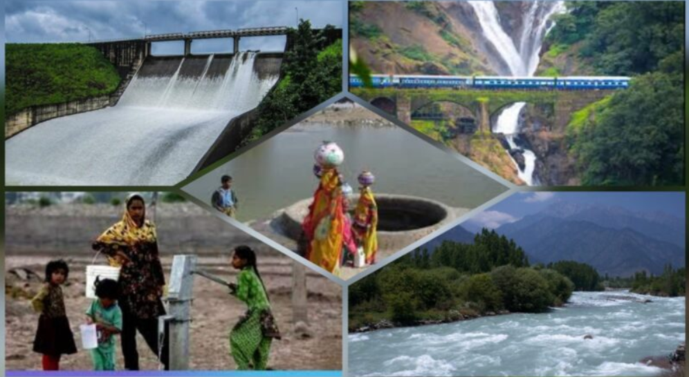
- While planning hydro power plants in Nepal, some extra care would be required to be undertaken. Nepal’s topography is unstable due to seismic activities. Hence, all hydropower plants with dam must be well planned and designed to mitigate the environmental impact. Also most Himalayan Rivers contain huge quantities of sediment with hard abrasive particles. The region’s climate and tectonic conditions as well as human activities are highly conducive for erosion and sedimentation. Therefore, sediment management is paramount for the safety, reliability and longer life of infrastructures (hydropower dam, equipment, roads, bridges, irrigation systems and drinking water).
As close neighbours, India and Nepal share unique ties of friendship and cooperation characterised by an open border and deep-rooted people-to-people contacts of kinship and culture. There has been a long tradition of free movement of people across the border. Nepal shares a border of over 1850 km with five Indian states – Sikkim, West Bengal, Bihar, Uttar Pradesh and Uttarakhand. The India-Nepal Treaty of Peace and Friendship of 1950 forms the bedrock of the special relations that exist between India and Nepal. Nepalese citizens avail facilities and opportunities at par with Indian citizens in accordance with the provisions of the Treaty. Nearly 6 million Nepalese citizens live and work in India. However Nepal is still not well developed and as has been explained earlier suffer from lack adequate energy to fuel its development. India has been a major partner in exploiting its indigenous energy resources and also making up the shortfall on this account.
Potential and Scope of Hydro Power Cooperation
Certain studies have been done to ascertain scope for the Indo-Nepal Cooperation in the domain of energy. It has been concluded that in the high build scenario, Nepal’s hydropower capacity is estimated to be 4551 MW. The generation cost in an arrangement of Indo-Nepal combined system would fall by approximately US $106 billion per year. This enhanced capacity will help Nepal to increase her power export to India by 60%. However Nepal’s high build out hydro resources would be fully utilised if operations between Nepal and India are further coordinated and an economic union strategy adopted by the two countries. Effectively, this would mean that trade with Nepal is institutionally is same as trade is between Indian States. Such enhanced power generation will help Nepal to become net exporter of power during dry as well as wet season, with reduced generation cost. On the contrary India ranks 81st in overall energy self-sufficiency at 66% in 2014 . Primary energy consumption in India grew by 7.9% in 2018 and it happens to be the third biggest consumer after China and USA, with 5.8% global share.
Details of Completed Projects for Energy Cooperation between India and Nepal
Motihari-Amlekhgunj Oil Pipeline: On 10th September 2019, the Prime Ministers of Nepal and India jointly inaugurated a cross-border oil pipeline through video conferencing. This line will transport fuel to the landlocked country. The aim of this pipe line is to cement India-Nepal ties in the face of major inroads made by China into the Himalayan nation, and seeks to repair the trust deficit between the two countries due to an economic blockade allegedly imposed by India in 2015 to persuade Nepal to change some provisions in its new constitution. Basically the protests at that time were done by people of Madhesh (region bordering India) as they felt that there were certain provisions of the constitution of Nepal which were discriminatory against them. India said at that time that the trucks laden with fuel and medicines, besides other essentials, were stopped by sections of Nepalese population (Madheshis) unhappy with some provisions of their constitution, which they felt were practically disenfranchising them. Nepal, however, viewed it as if India was blocking the supplies to compel Kathmandu to amend the provisions of the constitution that was seen as disenfranchising almost half of the Nepalese population. Therefore, the current initiative seeks to rebuild the confidence between the two countries and will help to bind Nepal closer to New Delhi, economically and strategically. The development comes against the backdrop of recent plans for a rail link between Nepal and China cutting through the Himalayas. There were also plans to link Nepal and China through an energy pipeline running through the Himalayas. Both were seen as means by Nepal to find an alternative to its dependency on India. The 69 km pipeline will transport fuel from the Barauni refinery in Bihar to Amlekhgunj in south-east Nepal and is the first cross-border petroleum products pipeline in South Asia. The Motihari-Amlekhgunj oil pipeline project was first proposed in 1996. The project was put back on the agenda during Prime Minister Narendra Modi’s visit to Kathmandu in 2014. The two governments had signed an agreement to execute the project in August 2015. Construction had begun in April 2018. Construction of the pipeline was undertaken by the Indian Oil Corp. Ltd (IOCL), India’s largest refiner, with an investment of over ₹324 crore, in collaboration with Nepal Oil Corp. Ltd (NOCL). The two sides are also working on building additional storage facility at the Amlekhgunj Depot, wherein NOCL has committed an estimated ₹75 crore. The pipeline can carry up to 2 million metric tonnes of petroleum products each year. Currently, petroleum products are carried from India to Nepal using oil tankers as part of an arrangement which has been in place since 1973. The NOCL not only hopes to save ₹200 crore annually with the new pipeline but will also ensure the transportation is no longer vulnerable to any kind of blockade.
Power Supply from India to Nepal: India and Nepal have a Power Exchange Agreement since 1971 for meeting the power requirements in the border areas of the two countries, taking advantage of each other’s transmission infrastructure. There are more than twenty 132 kV, 33 kV and 11 kV transmission interconnections which are used both for power exchange in the border areas and for power trade. For enhanced transmission of electricity, the first high-capacity Muzaffarpur (India) – Dhalkebar (Nepal) cross-border power transmission line (initially charged at 132 kV), with GoI Letter of credit (LoC) funding of US$ 13.2 million, was completed in 2016. Two additional 132 kV cross-border transmission lines between Kataiya (India) – Kusaha (Nepal) and Raxaul (India) – Parwanipur (Nepal), built with GoI grant assistance, were completed in 2017. India is currently supplying a total of about 450 MW of power to Nepal. An Agreement on ‘Electric Power Trade, Cross-border Transmission Interconnection and Grid Connectivity’ between India and Nepal was signed on 21 October 2014. The Agreement is aimed at facilitating and further strengthening cross-border electricity transmission, grid connectivity and power trade between Nepal and India. The Agreement provides a framework for power trade between the two countries, import by Nepal from India until it becomes power surplus and subsequent import by Indian entities from Nepal, on mutually acceptable terms and conditions. Two mechanisms, Joint Working Group (JWG) and Joint Steering Committee (JSC) envisaged under the Agreement have been established. Joint Technical Team (JTT) was formed for preparation of a long-term integrated transmission plan covering projects up to 2035.
Cooperation in the Domain of Hydro Energy: Cooperation in water resources primarily concerning the common rivers is one of the most important areas of bilateral relations. A large number of small and large rivers flow from Nepal into India and constitute an important part of the Ganges River basins (Refer Map-3 above). These rivers have the potential to become major sources of irrigation and power for Nepal and India. A three-tier bilateral mechanism was established in 2008, to discuss issues relating to cooperation in water resources, flood management, inundation and hydropower between the two countries. A Development Authority was set up in September 2014 to carry out the Pancheshwar Multipurpose project. A Power Development Agreement (PDA) for the 900 MW Arun-III hydroelectric project between India’s Satluj Jal Vidyut Nigam Limited and the Investment Board of Nepal (IBN) was concluded in November 2014. Also, a PDA for the 900 MW Upper Karnali hydroelectric project was concluded between IBN and M/s GMR in September 2014.
Projects under Planning/Execution
Pancheshwar Multipurpose Project: India and Nepal had signed a Treaty known as Mahakali Treaty in February’1996. Implementation of Pancheshwar Multipurpose Project is the centerpiece of the Mahakali Treaty. Required field investigations for the Pancheshwar Multipurpose Project have been completed by a Joint Project Office (JPO-PI) in 2002 (except for some confirmatory tests). But mutually acceptable DPR of Pancheshwar Project is yet to be finalised. The constitution of Pancheswar Development Authority has already been notified. Pancheshwar Multipurpose Project (PMP) is a bilateral project, primarily aimed at energy production and augmenting irrigation in India and Nepal. A Treaty known as “Mahakali Treaty” concerning the integrated development of the Mahakali River, which included Sarada barrage, Tanakpur barrage and Pancheshwar Dam Project, was signed between the Government of Nepal and the Government of India on February 12, 1996. During the year 2009, pursuant to the Article-10 of the Mahakali Treaty, the Government of India and the Government of Nepal agreed and framed draft ToR for setting up the Pancheshwar Development Authority, as an independent autonomous body, for development, execution and operation of the Pancheshwar Multipurpose Project. To accomplish this shared goal, the Terms of Reference (ToR) of the PDA as agreed upon by the two Governments and as may be amended from time to time, were created. As per the Statute of PDA the administrative organs of the authority are the Governing Body (GB) and the Executive Committee (EC). In order to execute the specific tasks assigned to the Governing Body, five meetings of GB have taken place so far. Pancheshwar Main Dam is proposed on River Mahakali (known as River Sarada in India), where the river forms the international boundary between the Far Western Development Region of Nepal and State of Uttarakhand in India. The dam site is around 2.5 km downstream of the confluence of River Sarju with River Mahakali. The project would comprise of a rock-fill dam with central clay core of 311m height from the deepest foundation level. Two underground power houses at Pancheshwar dam, one on each bank of Mahakali River, each with a capacity of (6×400 MW) with the total installed capacity of nearly 4800 MW are proposed to be constructed. The power plant at main dam will be operated as the peaking station to meet energy demand in India and Nepal. A re-regulating dam at Rupaligad is proposed around 27 km downstream of the main dam to even out peaking flows released from Pancheshwar power houses for meeting downstream irrigation water requirement. Here, two underground powerhouses on both sides of river with total installed capacity of 240 MW (2 x 60 MW on either bank) are envisaged. The main dam (when impounded with water up to Flood Regulating Level (FRL)) will form a reservoir of around 11,600 hectare area with a gross storage volume of about 11,355 million cubic metres. The submergence area on Indian side is 7,600 hectare, covering districts namely Pithoragarh, Almora and Champawat in the state of Uttarakhand whereas remaining 4000 hectares of submergence will be in Nepal. The project aims at producing hydro power and enhance the food grains production in both the countries by providing additional irrigation resulting from the augmentation of dry season flows. Year round irrigation will be possible in agricultural land in Kanchanpur district in Nepal due to enhancement in flows during non-monsoon months. The project will generate Two underground power houses at Pancheshwar dam, one on each bank of Mahakali River, each with a capacity of (6×400 MW) with the total installed capacity of nearly 4800 MW are proposed to be constructed. The power plant at main dam will be operated as the peaking station to meet energy demand in India and Nepal. Power generated will be shared equally between both the nations as per Treaty. Irrigation benefits in form of annual irrigation will be about 0.43 Mha, out of this, annual irrigation in Nepal would be 0.17 Mha and remaining 0.26 Mha in India. In addition, due to moderation of flood peak at reservoir(s), incidental flood control benefits for both the countries are also envisaged from the project. Pancheshwar Multipurpose Project is one of the top priority projects to be implemented in phased manner to reap the benefits of the project as early as possible. The work of preparation of Detailed Project Report (DPR) was entrusted to Water and Power Consultancy Services Limited (WAPCOS) by PDA and WAPCOS have in turn submitted the draft final DPR of the project to PDA in November, 2016. At present the finalization of Detailed Project Report (DPR) of the project is underway. A Team of Experts/Officials has been formed by both the countries for discussing and resolving all issues towards finalization of the DPR. After finalization of DPR, the Pancheshwar Development Authority shall undertake the execution, operation and maintenance of the project, including the work of re-regulating dam at Rupaligad site in an integrated manner.
Sapta-Kosi High Dam Project and SUN Kosi storage cum diversion scheme: After exchange of letter of Understanding between the two Governments in June’ 2004, a Joint Project Office (JPO) was set up in August’ 2004 to undertake detailed field investigations for preparation of DPR of SaptaKosi High Dam Project at Barakshetra in Nepal. DPR is under progress.
Kamla and Bagmati Multipurpose Projects The JPO-SKSKI has also been entrusted to undertake the feasibility study of Kamla Dam and preliminary study of Bagmati Dam Projects. These studies are in progress.
Project Completion Prospects
Hydro power projects have a long gestation period and therefore, it can safely be assumed that the export from Nepal of power will not be able to commence before 2025. Nepal will be able to export 18 billion kWh in 2025 which will go up to 93 billion kWh by 2035 and then will start flattening and by 2040 it would be 115 trillion Watt hour because by that time it is anticipated that because of the growing prosperity domestic consumption will also pick up. In rainy season when the reservoirs will be at their peak capacity, it is estimated that by 2030 13 GW would be available for export.
Conclusion
Notwithstanding the political division within South Asia, it is important to appreciate that the energy resources are monolithic in nature. Due to topography of the country most of the hydropower resources are concentrated in the Himalayas; spanning Nepal, Bhutan and Indian states of Arunachal Pradesh, Sikkim, Uttarakhand and Himachal Pradesh. Hydro power is a form of green energy and it would be ideal in case a mechanism can be evolved to exploit it for common good. It is essential that India, in conjunction with Nepal, Bhutan and Bangladesh, needs to make attempts to make use of energy resources available in all these countries; hydro power is one such resource. In this connection the platform of BBIN (Bhutan-Bangladesh-India-Bhutan-IndiaNepal) needs to be exploited. In fact recent pipeline laid by India between Motihari in Bihar and Amlekhgunj in Nepal is great example of cooperation that benefits the region and the parties involved.